Mainstreet 2021: Waynesboro Visualizations
This was part of a small seed fund for Waynesboro in Virginia.
- Nature-related topics:

- Urban-related topics:
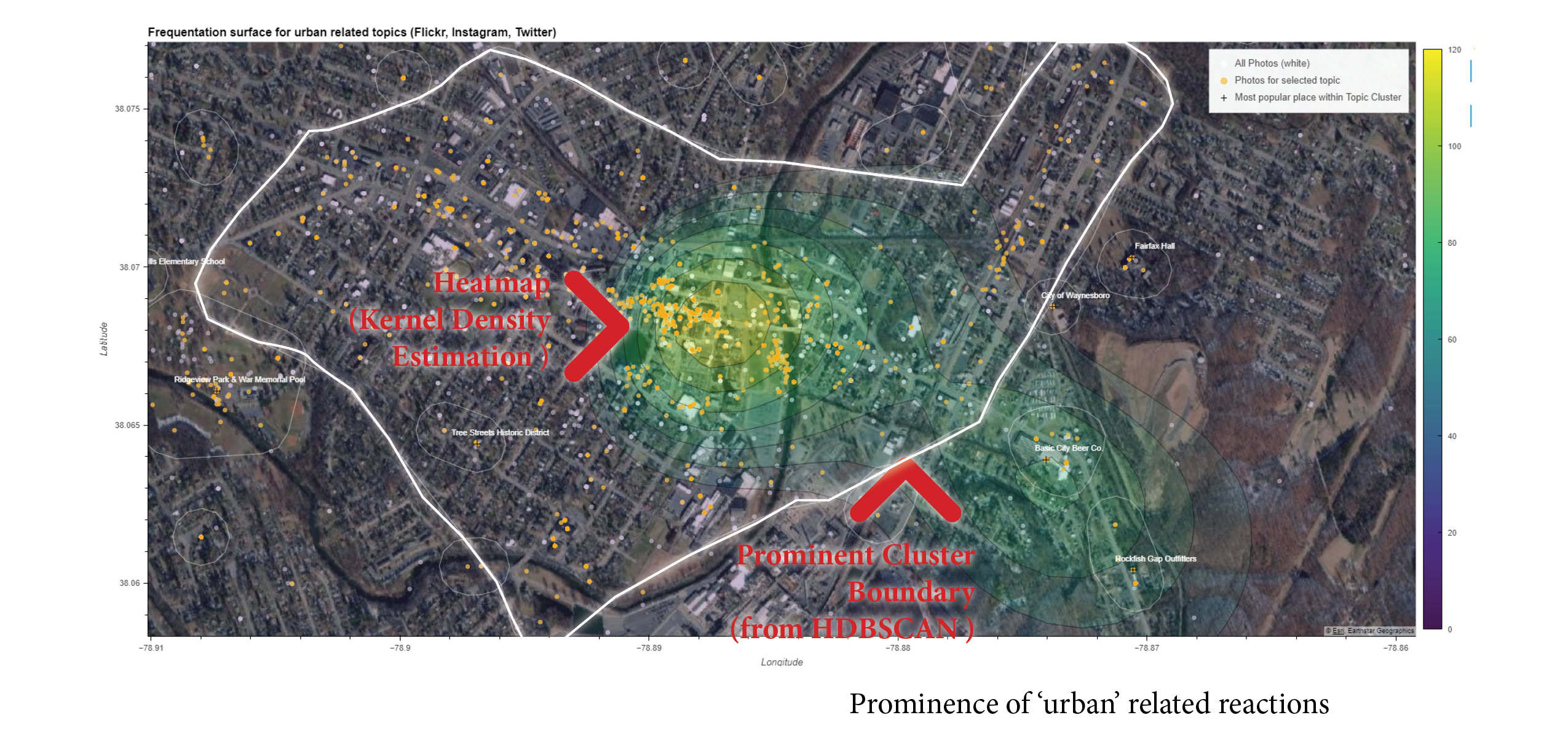
In the background, the algorithm first creates a “surface” (heat map) for all available social media posts, then for the selected topic (based on a set of terms), and afterwards normalizes the topic surface based on overall density.
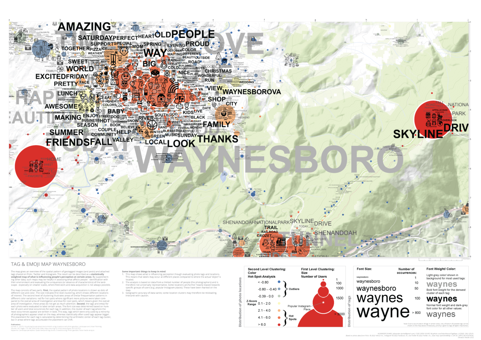
Note that there’s only limited data available for Waynesboro (90969 posts), so the results may contain noise.
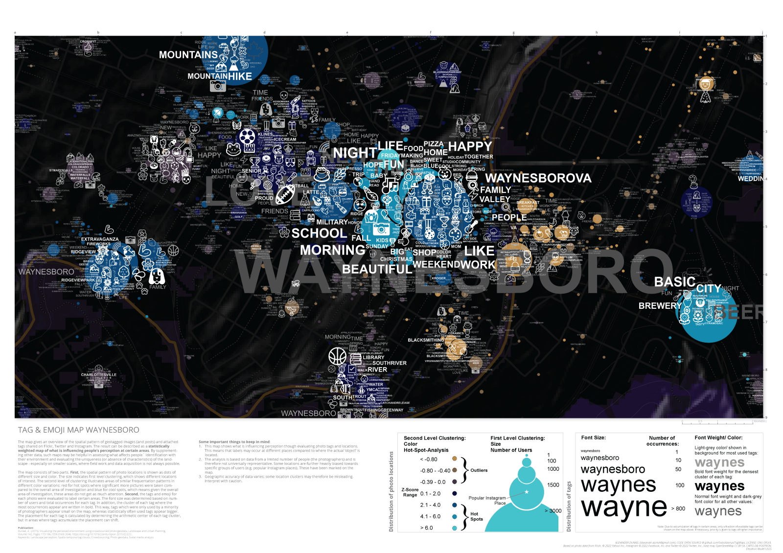
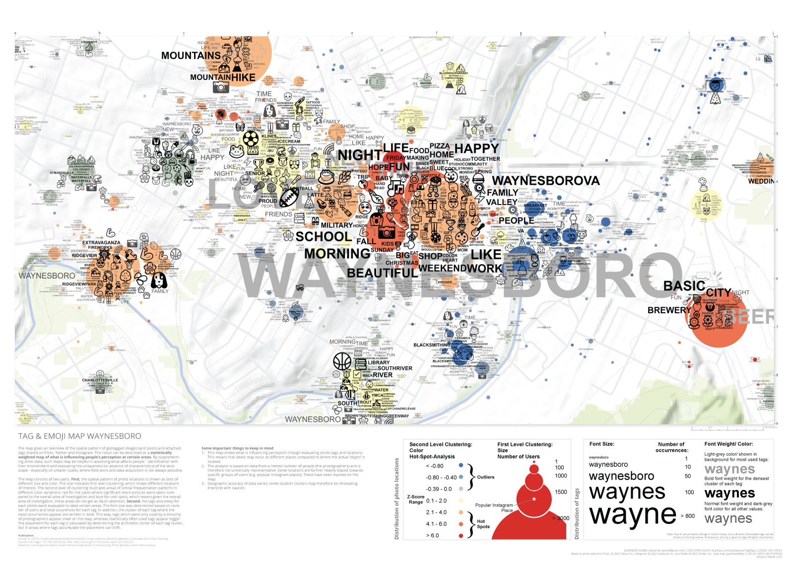
Tag Maps
Waynesboro close (dark theme):
Waynesboro close:
Waynesboro Overview:
Dashboard
Dominik Weckmüller (MSc) has also created a HLL Dashboard prototype for Waynesboro, which can be viewed interactively here: https://geo.rocks/dashboards/waynesboro/
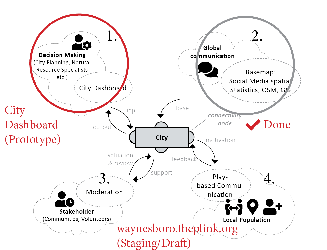
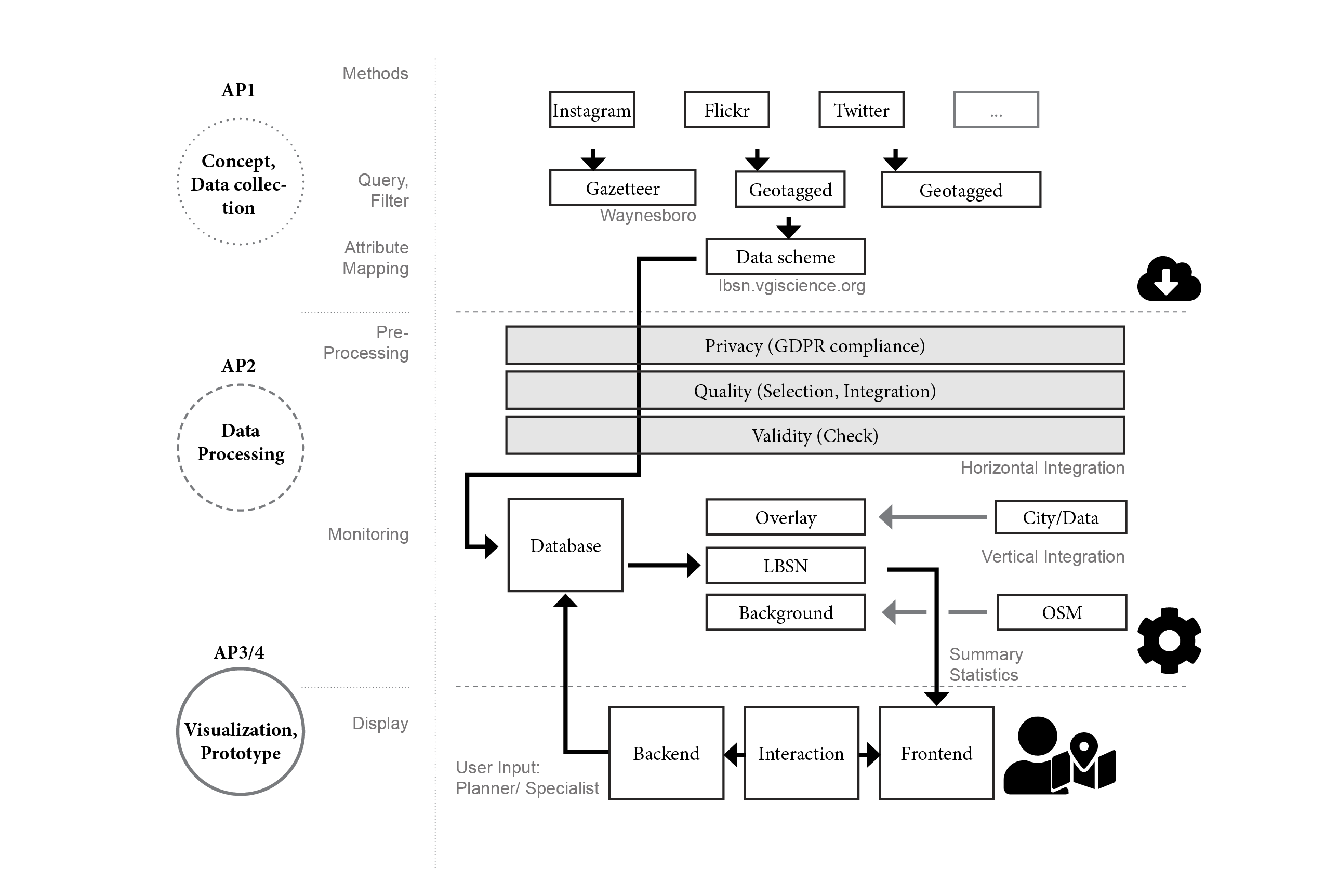
Data Flow
This is a overview scheme for the data flow, processing, and integration:
Together with the dashboard, we are making progress in supporting cities regarding
four sources of VGI data: