Tag Map Oderbruch & Lübecker Bucht
 (PDF Link)
 (PDF Link)
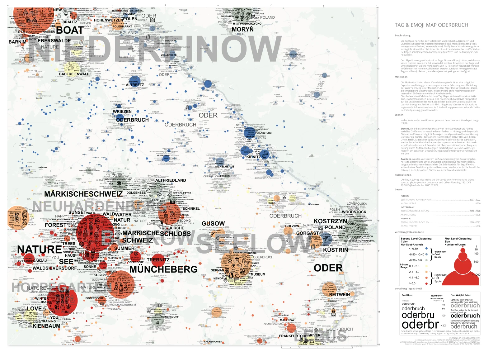
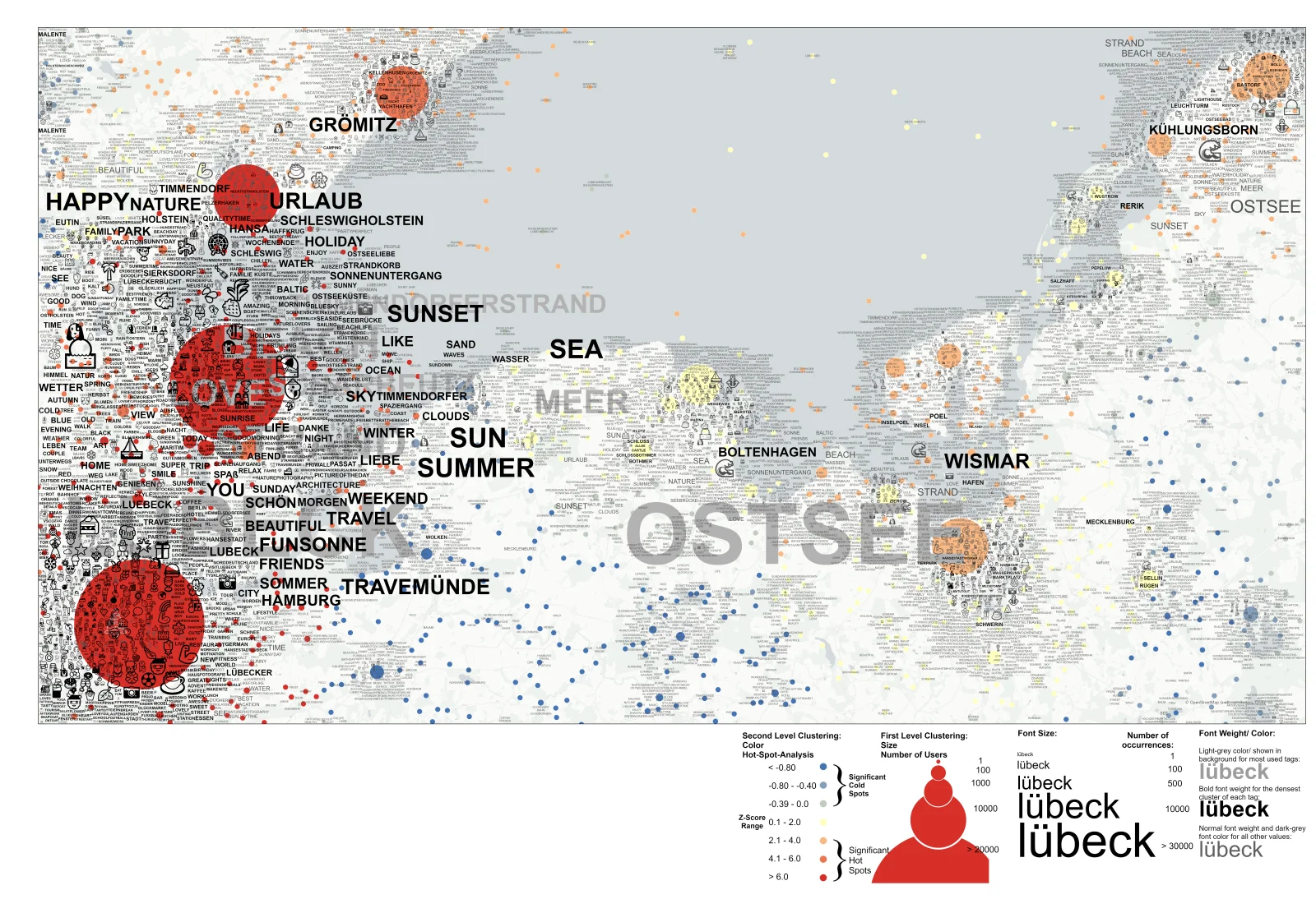
These were two recent Tag Maps I contributed to landscape planning projects in Germany.
The data statistics for the Oderbruch are included in the PDF. For the Lübecker Bucht, the data basis included 135,384 geotagged pictures from Instagram (up to 2020), 161,302 geotagged tweets from Twitter (up to 2022) and 141,237 geotagged photographs from Flickr (up to 2022).
Both regions are core vacation destinations in Germany and the primary goal of these projects was to understand tourist flow and visitor landscape preferences.