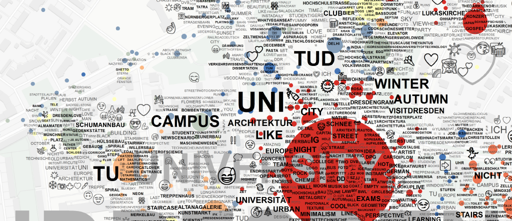
Spatio-Temporal Tag and Photo Location Clustering for generating Tag Maps
Tag Maps are similar to Tag Clouds, but Tag Maps use the spatial information that is attached to geotagged photographs, in addition to tag frequency, to visualize tags on a map. This Library uses the single-linkage tree that is available from HDBSCAN to cut trees at a specific, automatic or user-defined distance for all available tags in the given dataset. Afterwards, Alpha Shapes are generated as a means to allow 'soft' placement of tags on a map, according to their area of use. Two Shapefiles are generated that can be used to visualize results, for example, in ESRI ArcGIS or Mapnik.